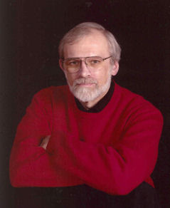
"If you don't offer walkable urbanism, you can write off your future development." - Christopher Leinberger
That was his answer when I asked about need for healthy development in the face Southeast Michigan's declining population and environment.
Leinberger, a Professor at the University of Michigan's Taubman School of Architecture and Urban Planning, and a Senior Fellow at the Brookings Institution in Washington, DC, was speaking at Concentrate's Speaker Series at The Ann Arbor Comedy Showcase. (No joke.)
After his talk, I pressed him further about Ypsilanti Township's situation - after all, that's where I live and where I'm a Planning Commissioner. He answered with a smile, "Ah, Ypsilanti! What a great town!" "But what about the Township," I insisted. "Focus, focus, focus on the downtown!"
Unable to monopolize the Great Man's attention further, I couldn't tell him that Ypsi Township doesn't have a downtown. But I can imagine his reply if I had. "Work with the City!" Can we actually work together, the City and the Township...?
I just read in today's Ypsilanti Courier that Paul Schreiber, the City of Ypsilanti's Mayor, addressed his City Council with a gloom-and-doom message last night. So bad is the financial outlook that not only could 65% of the City's general-fund employees be laid off, but those that remained would have their health insurance capped or cropped. The Township isn't much better off, with the work-week reduced to 30 hours and mandatory furlough days.
The City's Water Street project was to be a great example of what Leinberger praised tonight as a "near-downtown" center of walkable urbanism. Instead, it's a $1.3 million annual debt load on the City and it's citizens. We've got to find a way to turn it from a burden into a profitable, tax-paying development. The City and the Township need to work together for that, because without a financially healthy urban center, neither of the Ypsilantis will pull through this financial crisis. But we can't seem to work together, can we?
It was Ben Franklin who said, "If we don't all hang together, then surely, we shall all hang separately."
Looks like we're about to prove him right. The noose is tightening around Ypsilanti, both City and Township. Let's get together and at least plan our development strategy jointly, beginning with walkable urbanism, a focus on downtown, and and end to greenfield development in the Township.
More on this later...
That was his answer when I asked about need for healthy development in the face Southeast Michigan's declining population and environment.
Leinberger, a Professor at the University of Michigan's Taubman School of Architecture and Urban Planning, and a Senior Fellow at the Brookings Institution in Washington, DC, was speaking at Concentrate's Speaker Series at The Ann Arbor Comedy Showcase. (No joke.)
After his talk, I pressed him further about Ypsilanti Township's situation - after all, that's where I live and where I'm a Planning Commissioner. He answered with a smile, "Ah, Ypsilanti! What a great town!" "But what about the Township," I insisted. "Focus, focus, focus on the downtown!"
Unable to monopolize the Great Man's attention further, I couldn't tell him that Ypsi Township doesn't have a downtown. But I can imagine his reply if I had. "Work with the City!" Can we actually work together, the City and the Township...?
I just read in today's Ypsilanti Courier that Paul Schreiber, the City of Ypsilanti's Mayor, addressed his City Council with a gloom-and-doom message last night. So bad is the financial outlook that not only could 65% of the City's general-fund employees be laid off, but those that remained would have their health insurance capped or cropped. The Township isn't much better off, with the work-week reduced to 30 hours and mandatory furlough days.
The City's Water Street project was to be a great example of what Leinberger praised tonight as a "near-downtown" center of walkable urbanism. Instead, it's a $1.3 million annual debt load on the City and it's citizens. We've got to find a way to turn it from a burden into a profitable, tax-paying development. The City and the Township need to work together for that, because without a financially healthy urban center, neither of the Ypsilantis will pull through this financial crisis. But we can't seem to work together, can we?
It was Ben Franklin who said, "If we don't all hang together, then surely, we shall all hang separately."
Looks like we're about to prove him right. The noose is tightening around Ypsilanti, both City and Township. Let's get together and at least plan our development strategy jointly, beginning with walkable urbanism, a focus on downtown, and and end to greenfield development in the Township.
More on this later...


 Posts
Posts