Saturday, December 28, 2013

Pavement-Guided Buses

Recent Developments in Public Transportation
Topic 1, Part 3

Bus Rapid Transit through Light Rail:
Pavement-Guided Buses

More complex systems for guiding buses (compared to curb-guided systems) make use of markers buried in the pavement or placed on the pavement's surface. These run on have rubber tires, and can be steered either manually or by computer-based hardware/software combinations.
Two systems are out there:
  • "Phileas": uses magnetic beacons embedded in pavement. It was developed by the consortium Samenwerkingsverband Regio Eindhoven (SRE), Netherlands, along with some other companies for the Cooperation Foundation Eindhoven Region - most prominently Advanced Public Transit Systems (APTS), VDL Bus and Coach, and Bombardier. A Dutch company, Frog Navigation Systems, developed the technology known as FROG that uses small magnets embedded in the road surface
  • "Optiguide": uses painted marks on roadway. Siemens (multinational), developed and owns the guidance system. To date, buses guided by Optiguide have been built by Iveco Irisbus (Italian), but probably any company willing to work with Siemens could design buses to use the system.
Both Optiguide and Phileas have a steering wheel for the operator. Guided operation is currently used only when very precise steering is needed. The vehicles can be guided to within an inch or two (5 cm) of the edge of a station platform, making boarding easy for people who depend on wheels of one kind or another to get around.

Phileas

Phileas vehicle (largest configuration)
(Photo: VDL Bus and Coach)

I haven't had a chance to visit a Phileas system, which so far has only been deployed in Eindhoven, Netherlands. A few other cities are in various stages of developing Phileas systems, but the overwhelming evidence seems to be that Phileas is "not ready for prime time".

For starters, there are been serious problems with the motive power. Several energy sources are available, including diesel, compressed natural gas, and straight electric from twin trolley wires. The power systems using fossil fuels are all hybrid (both series and parallel have been tried) but have experienced difficulties with the hybrid transmission systems.

But most serious of all, there have been major problems with the FROG ("Free Range on Grid") magnetic guidance system. FROG automatic guided vehicles have been demonstrated to be effective in controlled environments, hauling cargo in warehouses and manufacturing facilities, and providing shuttle service at airports. But when let loose on the streets of Eindhoven, they proved both reckless and easy to confuse. In automatic mode, they attempted to accelerate the buses to the maximum allowed speed, without regard to pedestrians. They would barrel along and, for various reasons, would stray from their appointed path. They were programmed to apply full braking power immediately upon straying more than 25 cm (about 10 inches) from their path. When this happened - and apparently it did fairly frequently - they would make an "emergency" stop, sending passengers flying. Traffic signals turned out to be another problem: perhaps because of the detector loops embedded in the pavement, the FROG system would become disoriented, signal a fault, and prevent the bus from moving forward.

These problems have proven difficult to overcome. As of last report (September, 2008), Eindhoven transit has discontinued use of the FROG system except for docking, and passengers have been calling it "Phileasco" (Phileas+fiasco). Other cities attracted to the potential of the Phileas system have been unable to procure buses, due to the constant need for the manufacturer to recall their vehicles for modification. As a result, Phileas cannot be considered a realistic option at this time.

Optiguide
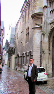
Olivier Rateuivillie
(Photo: L. Krieg)

I was fortunately able to visit Rouen, France, the first city to deploy the Optiguide system, in 2001. (Castellón, Spain is the only other one so far.) Olivier Rateuiville, public affairs officer for the transit authority of Rouen, was kind enough to show me around when I was visiting in October.


The Optiguide system uses a simple pattern of white lines painted on the pavement. In the bus, a sophisticated hardware/software combination detects the guidelines through a video camera and signals the driver when it is about to take over the steering. Unlike FROG, Optiguide does not attempt to control starting, stopping, or speed - these all remain the driver's responsibility. And when necessary, the driver can override the automatic steering.
Rouen BRT with Optiguide
Bus-only lanes (red pavement with guide marks)
Bulge on bus-top houses guidance video equipment
(Photo: L. Krieg)


In Rouen, the buses use automatic guidance only when they are approaching a station on the main BRT route. Rouen built a BRT corridor through the most congested parts of the city, and this corridor is shared by three routes which fan out into different suburbs. Once past the central corridor, the buses run in lanes shared with general traffic, and are operated like standard articulated buses.
Map of Rouen BRT Routes
(Map: CREA; English overlays: L. Krieg)


Here's some video I shot while I was there:

Olivier gave me a presentation - apparently many other cities have sent delegations to observe their Optiguide. This presentation gives an overview of the history and finances, as well as the BRT infrastructure and operation. I was interested to note that operating funds amounting to €372,000 was spent in 2010 for "Guidage véhicule" (vehicle guidance), but did not ask for an explanation. I would have expected the vehicle guidance system to be a capital expense, rather than an operating expense amounting to about 23% of the infrastructure maintenance cost. The capital cost of the Optiguide system is rolled into the vehicle cost, and its actual cost is not readily available.
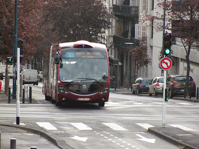
Optiguide in Clermont-Ferrand
(Photo: L. Krieg)

Pros and Cons

Due to the problems with Phileas, I'll list here only the Pros and Cons I see for the Optiguide system:
Pro Con
Flexible: to guide or not to guide, according to needs Pavement must be kept clear
Based on available bus models (potentially multiple vendors) Only one guidance system vendor (Siemens)
Uses well-defined BRT systems Very few installations
More expensive than curb-guidance systems

To learn more:

Tuesday, December 24, 2013

Walking Uphill

Today, I'm taking a break from the "BRT Spectrum" to write a note about walking uphill. Uphill that is, from the current Ann Arbor Amtrak station to University of Michigan Hospital's main entrance. I did this because I've thinking about the walk for many moons, but never actually did it.

Why worry? Because the many people who work at or visit the Hospital (UMH) will be expected to do this if the Ann Arbor station stays at its current location.

You see, the other option is to put the station right by the hospital - the largest single employer, and the fastest growing, in the county. But a number of people in Ann Arbor believe the land next to the hospital would be better off as a park - which it was several decades ago.

My concern is the environmental impact of having a station that's too far to walk to and from. But is it really? Today is December 24, Christmas Eve, so not many people are working (except in hospitals). Traffic was light at 9:30 AM when I set out, but the wind was bitter, sweeping 14 degree air out of the West up Fuller Road at my back. In spite of the uphill trudge, I managed a brisk pace. The warmth of the main hospital entrance was very welcome after 18 minutes. Following a brief warm-up, I headed back down. The sun had finally crested the tops of the hospital complex, the sky was clear, and the temp was up to what felt like a balmy 16. The wind had also moderated, and I only got a couple of frigid gusts as I topped the rise above the Gandy Dancer restaurant. But it took 20 minutes, where I had expected a downhill 15 - the sun must have relaxed me.

OK, so I've never been athletic, and I've even slowed down a bit over the years, but I enjoy walking and do it quite a bit. I guess my walking speed is pretty average, and 20 minutes is a good round number for the time it would take. Google Maps (below) makes the distance 0.9 miles, and walking time 18 minutes, pretty darned close to my reality.
(Click the image to enlarge it)

So how many of the people commuting to UMH would be likely to walk 18 minutes from the train station and 20 minutes back at the end of the day? Thirty-eight minutes out of the day is pretty steep for most twenty-first century people. And many of the folks working at hospitals do so on their feet for eight or more hours every day. I'd say it would be a rare person who'd be willing to give up their car and commute by train+foot to their job if this were California. Factor in Michigan weather, and the number drops even more. And in spite of the efforts of Ann Arbor City Council, we didn't make it to Walkscore's "Top 10 Most Walkable College Towns" (linked below).

Planners often refer to the quarter-mile (400m) limit to people's willingness to walk to transit. (This is said to be somewhat farther in Europe.) Kaid Benfield, of the Natural Resources Defence Council, posted a thoughtful blog (linked below) in July of 2012, in which he discusses various reasons why people are willing to walk longer or shorter distances. I'm afraid the walk from the current station to the hospital doesn't do well on any of the scoring methods he mentions.

Jarrett Walker has an extended discussion of walking distances (linked below) in which he cites the Transit Capacity and Quality of Service Manual, providing this graphic:
(Click the image to enlarge it)

This is interesting because it shows variation in the percentage of people willing to walk in different North American places. Calgary, Alberta, has the most intrepid walkers; citizens of Edmonton - quite a bit further north in the same Canadian province, are willing to walk considerably less far. (Is it that much colder...?)

What's really important is the difference revealed between Washington, D.C., residents of different income levels. Not surprisingly, low income people are willing - or are obliged - to walk quite a bit further than their more fortunate neighbors. Half of them are willing to walk 225 meters, while half of high income people are only willing to walk 100.

What does that say about where we locate the Ann Arbor train station for commuter rail? The distance between the station and the hospital's main entrance is 1448 meters, which vanishingly few people are willing to walk - even in Calgary. Of course, lower income people might walk that far if they had to, but - if the D.C. figures tell the truth about this - higher income people would almost certainly not. Rail commuter service would be subtly pushed into being exclusively for lower income people.

But wait - isn't the current station closer to downtown, anyway? Well, yes. Google puts it 0.7 miles (1125 meters) from the station to the Blake Transit Center (which I'll use as "downtown" for consistency with the WALLY station study). 1125m is still way beyond the distance most people are willing to trudge. So either potential station location is too far for most people to walk downtown.

Unless the train station is moved closer to UMH, practically nobody would walk. They'd have to be bussed. Sounds simple, but I'm told there are serious problems with that option. Depot St. and Fuller St. are narrow, and would be difficult to widen because of the topography and buildings around it, making it difficult for buses to turn around. They would have to go around several blocks, rather than run directly between the station and the hospital. Also, Depot is quite congested during morning and evening peak periods, so both buses and walkers would have difficultly crossing without enforcement of some kind - which, in turn, would cause traffic backups. Fuller Road in front of the hospital, on the other hand, is broad: 4 lanes with left-turn lanes at the hospital entrance and a turnout to reach the place where the station could be built.

All this adds up to one cold, hard fact. Depot Street is not the place for a commuter service station, much less an intermodal transportation center. The hospital location is, with hundreds of buses passing every day, both from the transit authority and the University's student and hospital transportation systems. If the station remains on Depot St., even with a new building and parking facility, rail service will not be a realistic option for most people. Instead, they'll continue driving their cars. The City and the University will continue to build parking structures to store the cars in. City transportation staff will continue tearing out their hair to try to accommodate traffic increases. Drivers will become more frustrated and their commutes will become longer - but without realistic options, that's how it will be.

Just like it is now, only worse.

To learn more:

Saturday, December 14, 2013

Bus Rapid Transit through Light Rail: Curb and Contact Guidance


A full spectrum of options
Recent Developments in Public Transportation, Topic 1 part 2
Continuing the previous post, we're looking at systems for guiding Bus Rapid Transit and similar vehicles. Today, we'll explore contact-guided systems.
Snohomish Community Transit Swift bus
Note the "rub-rail" on the lower yellow portion
of the edge of the platform. Photo: L. Krieg

Contact-guided vehicles

There are a couple of solutions for guiding a vehicle by contact.
Station platform for Eugene, Oregon's EMX BRT
Here, the rub-rail is clearly shown by its yellow paint
Photo: L. Krieg

Tire-guided contact is when there is a "rub-rail" on the sides of station platforms to dock the bus accurately. The "rub-rail" allows the operator to feel positive contact through the tire to the steering wheel, but holds the wheel far enough away from the platform edge to prevent damaging contact to other parts of the bus (such as bumpers, lug nuts, or skirting). This system is used, for example, by Community Transit's Swift service in Everett, Washington.
Snohomish Community Transit's Swift BRT
The bus is docked with the tire against the rub-rail.
Note the size of the gap between platform edge and bus floor (3-4 inches):
A wheelchair would probably need the operator to deploy a bridge in order to cross the gap;
a stroller or walker could probably be maneuvered without a brdige.
Photo: L. Krieg

Contact guidance is only practical at very low speeds; otherwise, wear on the tires becomes expensive and even dangerous. For safe guided navigation in general, a small horizontal guide-wheel is used in contact with a curb or rail.
Mannheim, Germany: guide-wheel on BRT vehicle.
(Note also the protective casing for the lug-nuts.)
Photo: Martin Hawlisch
Wikimedia Commons
. Reproduced under the terms of the GNU Free Documentation License

These wheels can also be used solely for docking - for example, in Cleveland Ohio's Health Line service. For navigation, a rail or concrete lip is installed along the side of the bus lane, as in Adelaide, South Australia's O-Bahn; and the Cambridgeshire Guided Busway in England.
A bus on the O-Bahn Busway route in Adelaide, Australia.
Photo: “Beneaththelandslide”
Wikimedia Commons. Reproduced under the terms of the GNU Free Documentation License

Pros and Cons of Contact-Guided Buses
Pro Con
  • Simple
  • Inexpensive
  • Relatively accurate docking
  • Rub-rails: any contractor can easily install them
  • Rub-rail: Operators say they don't like striking curbs with their vehicle
  • Rub-rail causes tire wear
  • Rub-rail is only applicable for low-speed docking, not for  running in constrained or twisting lanes
  • Guide-wheel: must install steel or concrete guide-rail
  • Guide-wheel: may make unpleasant grinding noise
Cambridgeshire, England Busway
Concrete lip of trackway provides guidance
Photo: Bob Castle
Wikimedia Commons. Reproduced under the terms of the GNU Free Documentation License

To learn more:

Tuesday, December 10, 2013

Bus Rapid Transit through Light Rail


A full spectrum of options
Recent Developments in Public Transportation, Topic 1 part 1
Los Angeles Metro Orange Line BRT vehicle

Questions for Southeast Michigan

As Southeast Michigan begins to implement rapid transit in 2014, the enabling legislation has specified a system using "rolling rapid transit", as defined in the Act. This raises a number of questions:
  • What exactly is "rolling rapid transit"?
  • What types of "rolling rapid transit" systems are available?
  • What are the strengths and weaknesses of each type?
  • Do systems with more aspects of light rail attract more private investment to their corridors?
In September 2013, I spent eleven days in France investigating transit systems in ten cities to try to answer these and other questions. But the first two questions are answered in the legislation that enabled the Regional Transit Authority (RTA) to come into being. Let's take a look there first, so we know what we're talking about.
REGIONAL TRANSIT AUTHORITY ACT
Michigan Public Act 387 of 2012
124.542 Definitions.
Sec. 2. As used in this act:

(o) "Public transportation system" means a system for providing public transportation in the form of light rail, rolling rapid transit, or other modes of public transportation and public transportation facilities to individuals.

...
(r) "Rolling rapid transit system" means bus services that may combine the technology of intelligent transportation systems, traffic signal priority, cleaner and quieter vehicles, rapid and convenient fare collection, and integration with land use policy. Rolling rapid transit may include, but is not limited to, all of the following:
(i) Exclusive rights-of-way.
(ii) Rapid boarding and alighting.
(iii) Integration with other modes of transportation
Los Angeles Foothills Transit. Articulated bus,
same model used by Orange Line, but not used as BRT

Though Sec. (2)(o) includes rail transit, for political reasons rail was made especially difficult to approve:
124.546, Sec. 6 (3) …
(b) A board shall provide in its bylaws that the following actions require the unanimous approval of all voting members of the board:
(i) A determination to acquire, construct, operate, or maintain any form of rail passenger service within a public transit region.

Is this “Rolling Rapid Transit”?

I discovered that, like many aspects of law, there are a number of fuzzy, undefined areas. Among other terms, “Bus” is not defined precisely. When a law does not define a term, an authoritative dictionary definition is generally used. Here is Webster’s Online Dictionary’s definition:
“1. a :  a large motor vehicle designed to carry passengers usually along a fixed route according to a schedule There is actually quite a spectrum of vehicles that fit this definition, from purely rubber-tired, free-steering “buses” to “light rail” vehicles with steel wheels rolling on steel rails.

What, then, is BRT?

Four features differentiate BRT from other types of city bus service – three alluded to in PA 357 Sec. (2)(r):

  • Dedicated lanes
  • Signal priority
  • Stations rather than stops
  • Pay before your board

Also BRT vehicles are usually larger than local transit buses (having two or three articulated sections). Many have wider doors, doors on both sides, or doors that match the height of station platforms. Most have internal combustion engines; a few use electric power from dual overhead wires (the trolleybus system).
Dedicated lanes for Los Angeles Orange Line.
Built on an abandoned railroad right of way.

A Full Spectrum

Between bus rapid transit and light rail, it turns out there's a full spectrum of choices. We'll look at two ways of classifying these systems - by how they are routed and relate to other traffic, and by how they are guided.

Here's an overview of how bus systems relate to other traffic:

  • Arterial Rapid Transit (ART)
    Similar to BRT, but does not have dedicated lanes
    Fewer stops than local transit buses
    Los Angeles Metro Rapid,
    an example of Arterial Rapid Transit

  • Express Bus: urban
    Follows the same general route as a local bus
    Does not stop at all stops in certain areas
    Does not have dedicated lanes
  • Express Bus: commuter
    Takes people from suburb to center city
    Usually has a significant portion of the route on a thruway
    No specifically dedicated lanes, though they often use HOV (High Occupancy Vehicle) lanes
  • BRT “lite”
    Has some features of BRT, but is missing others
    May have BRT features in some places, but not in all.
Los Angeles Metro Rapid bus
This could also be seen as "BRT Lite"

Now about how they're guided

There are a couple of reasons to provide automatic guidance systems for transit vehicles...
  • Docking: this is when the vehicle comes in to a station. The idea is to make it really easy for people to get on and off. To achieve this, the floor of the vehicle and the station platform should be at the same level and very close together - but not touching. This makes it much faster for people to get on and off, and anyone with a wheeled vehicle (wheel chair, stroller, or just baggage) won't have to worry about gaps or steps. It all adds up to getting everybody where they're going more quickly and smoothly.
  • Safe navigation: it's very tricky for a driver to steer a large vehicle through narrow, twisting lanes. It can be done more safely and rapidly if the vehicle is guided by a mechanical or computerized system. If a transit system is to have dedicated lanes, it makes sense to make them as small as possible, to leave as much room as we can for other traffic.
Conventional BRT, which best fits the definition of “rolling rapid transit” given in Public Act (PA) 387, runs on rubber tires and is steered by an operator. Many BRT installations have docking guidance, and some have safe navigation guidance as well.
Los Angeles Metro Silver Line vehicle.
This is BRT that runs on restricted thruway lanes.
It is steered manually by the operator.

If BRT is one end of a spectrum, the other end is Light Rail Transit (LRT), which runs on steel wheels and is steered by steel rails and switches rather than by an operator. The rails serve as a full-time automatic guidance system for both docking and safe navigation.

In between BRT and LRT lie four variants:
  • Vehicles on rubber tires guided by contact with a roadside rail or curb part or all of the time
  • Vehicles on rubber tires guided by optical or magnetic technology part or all of the time
  • Vehicles that run on rubber tires and can be steered by a central steel rail part or all of the time
  • Vehicles on rubber tires that are steered exclusively by a central steel rail
Over the next few blog entries I will be taking a look at each of these four variants. In the first of these we'll see what's available in curb guided guided systems.
Los Angeles El Monte Station
Serves several LA Metro and Foothills Transit bus routes
This is the western terminus of the Silver Line


To learn more:

Thursday, October 31, 2013

How Fares the Eco-City?

I'm writing this as I race east aboard a French Intercity train (not a TGV) from Bordeaux to Toulouse. I'm in France for a couple of reasons, both "business", if you need to know. A couple of people asked if I was going for business or pleasure, and the answer is that it's for a very pleasurable business. After all, it was my choice to investigate transportation around the world and bring back to Michigan whatever best practices I've found.
I see it's been three months since my last blog post, and and I apologize for the silence. A lot has happened since then. I've been accepted as a member of the Southeast Michigan Regional Transit Administration's Citizens' Advisory Committee. That has meant a lot of meetings, though not of the CAC itself. And I've been asked to serve as Ypsilanti Township's representative on the Ann Arbor Area Transportation Authority, though that has not yet been confirmed. I've also got a couple of projects under way for Trans4m and MARP.
So the two angles I'm working here in France are (1) the EcoCities Summit, and (2) innovative light rail and bus rapid transit technologies. Let's hit EcoCities in this post, and leave transit technology for later, OK?

EcoCities Summit

In 2008 I went to my first EcoCities conference, in San Francisco. The conference is the brainchild of Richard Register and his EcoCities Builders organization. The idea is to bring together all the elements necessary to build sustainable cities throughout the world. That includes just about everything needed for cities to "live long and prosper": healthy food, good water, clean air, social justice, upbuilding education, and efficient transportation.
Nantes was chosen as the host of EcoCities
partly because it had been declared
the 2013 "Green Capital" of Europe.
The 2008 conference was very inspiring: lots of ideas, big and small, were enthusiastically expounded. Many of them had to do with innovative city designs. There was an ebullience, a sense of hopeful energy, a feeling that change for the better was in our grasp.
That was before the crash.
The 2013 conference had more of a sense of fighting our way out of from quicksand. Many of the most hopeful ideas were centered not on what to do, but on how to finance whatever we should be doing. I only ran across one innovative city design, from the Italian architectural firm of JMSchivo&Associati. The general concept is a ring of mixed-use sections or "cells" surrounding a central river/lake and green area, with gardens, parks, forests. The ring is theoretically about one kilometer across, making it easy to walk from any section to any other or to the green center. Rather like my proposed greenfield town turned inside-out.
From Bhutan, we heard from Dasho Dr. Sonam Tenzin. He illustrated for us the Bhutanese idea that nations should measure their Gross National Happiness rather than Gross National Product, while most of the other invited speakers maintained their stodgy ideas of measuring success by economy. I'd like to write more about that later.
François Delarozière's "Green Expedition"
display in central Nantes
From Silicon Valley, we heard about the Urban Observatory from Shannon McElvaney of ESRI. This is a way of comparing the "big data" available from cities around the world in several different areas of interest. On the Web, you can compare three cities at once; in its physical implementation, large screens are set up showing twelve at once.
From Medellín, Colombia, a really encouraging glimpse at a city rising from fear to fulfillment. We used to hear of Medillín only in connection with the drug trade, as home of the fearsome Medellín Cartel and its ruthless leader, Pablo Escobar. Ana, a young woman representing the Mayor (her name unfortunately doesn't appear in the program) gave a quick but powerful talk about the rise of Medellín from fear through hope to action. Their financing methods involve public corporations whose earnings are used solely for


building up city infrastructure and services, but details weren't given in enough detail for me to pass them along. Medellín is hosting a major conference in April next year, which I hope to be able to attend. And that says a lot, as I never wanted to go to Colombia before, and especially not Medellín.
Finally, kids of guests and, I assume, kids from Nantes itself, were invited to build their ideal "city" using Legos, with sponsorship from Lego). The general outlines are lost in the mass of detail, but I did notice the presence of warriors in one part of a city, presumably built by a little boy. For better or for worse, I suppose human boys will always have the seeds of violence in them.
A child-built Lego "EcoCity"
with warrior guards

So let's keep up the struggle to get out of the economic "quicksand", get free from the violence, into unpolluted, sustainable, and prosperous cities.

Friday, June 28, 2013

Atlanta Transit-Oriented Development


I'm in Atlanta at the "Transit Initiatives and Communities" conference, and like many transit conferences there are tours of interesting things. Yesterday, two tours were offered, which tested our mettle for walking and standing in Atlanta summer weather (and it wasn't too bad...for Atlanta!)

Quick Streetcar Detour

Auburn Avenue looking east toward Ebeneezer Baptist Church

Monday morning was a walking tour of the new Atlanta streetcar line under construction. And we did walk the entire line, which is a loop, from Centenial Olympic Park on the west to Ebeneezer Baptist Church and the Martin Luther King Jr. Historic District on the east. We got to see the streetcar line in several stages of construction, from barely begun to almost done. This pic on Auburn Street shows the track slab nearly done, with Ebeneezer Baptist in the background. This is the church where Martin Luther King Jr. was baptized and later became co-pastor with his father. The streetcar line will run northward beside the church before turning west on Auburn.

Atlanta's TOD

But I wanted to share the transit-oriented development scene in Atlanta. MARTA (Metropolitan Atlanta Regional Transit Authority) began running heavy-rail service in 1979. The system now consists of a north-south line with two branches on the north side of the city (Red and Gold lines), and an east-west line with one minor branch on the west side (Blue and Green lines), crossing downtown at Five Points station. (http://en.wikipedia.org/wiki/File:MARTA_Rail_Map.svg) Route miles total 48.1, wth ridership of about 72 million trips per year in 2012. The "bread and butter" of the system is its 91 bus lines, almost all of which originate at MARTA rail stations.

Credit: MARTA
In the late 1990s, MARTA decided to launch TOD. Lindbergh Center Station is their flagship development; several of us enjoyed a tour guided by Dr. John Crocker (MARTA Director of Development and Regional Coordination), and Gregory Floyd (MARTA Senior Land Use Planner). According to their narration (as I heard it), MARTA purchased land around the station during its initial construction in the 1970s for use as a park-and-ride lot. In 2000 they purchased more land, including some buildings, bringing the total land owned by the agency around the station to about 47 acres; at the same time, they lengthened the platforms to accomodate longer trains and added a second entrace with direct access to the lengthened platforms via stairs, escalators, and a second elevator.

Lindbergh Station, new section, looking southwest toward TOD apartments
To make room for new development without reducing parking space, they built two new parking structures; other work was done to encourage development, such as putting in water and sewer, electric service, and a gridwork of streets. The investment in the enlarged station, parking structures, and utilities cost close to $100 million, paid for largely by a Federal grant. Predictably, the neighbors resented having their area developed, and mounted a stiff opposition, which required sensitive negotiation and significant mitigation.

Lindbergh Station looking northeast toward AT&T west tower
Development came quickly in the form of two office towers just east of the station (about 10 stories tall) for use by AT&T - originally Southern Bell - whose world headquarters is about three miles south of Lindbergh Station. (Atlanta was - and still is - growing significantly in population.) South and east of the station is a mixed-use 3-4 story complex, and west of the station are two blocks of 4-5 story apartments. All very nicely decorated with trees and "street furniture", walkable and pleasant.

Credit: MARTA
MARTA has encouraged development by offering very reasonable 99-year ground leases. From this, they reap about $2.5 million annually. Compared with the investment of $100 million, this seems relatively low. I suspect - though I didn't ask - that the rate is not adjusted for inflation as the years go by. Absent inflation, this is about 2.5% return on investment annually, but if inflation is over 2.5%, it's a theoretical loss. There are two advantages for MARTA, though: first, the majority of the initial investment was paid with Federal, not MARTA's, funds, so actually most of the return is pure profit for MARTA. In addition, like most transit agencies, MARTA has difficulty raising the local portion of its operating funds - it uses mainly a 1/2 cent sales tax, and when recessions curtail sales, this income dwindles. The constant income from land leases like those around Lindbergh Station are a hedge against these fluctuations. The total coming from such leases around MARTA's region is about $5 million annually. Though a relatively small part of their operating budget, it's always welcome.

And in Michigan?

As our Regional Transit Authority plans to establish its transit lines, it will need to acquire land for any significant stations. If this can be done on terms as advantageous as those made to MARTA (a straight grant), it would be a significant chance to develop both income and TOD. There are only two problems....

First, Congress - especially the House - is currently in a very parsimonious mood. Very little money is being made available for grants like the one MARTA used, and though nobody's crystal ball is perfect, prospects for more free grants look very dim.

Second, the Southeast Michigan RTA, as enabled by statute, is required to use (mainly) rubber-tired vehicles. So far, at least, rubber-tired transit has not performed as well as steel-wheeled (rail) transit in attacting investors. Bus Rapid Transit by its nature cannot move as many people as heavy rail subway-type trains, so the commercial advantages of large numbers of people passing through subway stations is greatly reduced with BRT. What is more, the main attraction of BRT for Michigan is its low initial cost. With a small initial investment, such as modest stations, we can't expect large returns down the road.
So let's bear these variables in mind as we plan, and (as I emphasized in the previous post) plan for the long-term future as best we can.
Credit: MARTA

To learn more:

Saturday, June 22, 2013

The Foresight Saga


You may be aware that I was a computer geek for thirty or forty years. As such, I became a member of two professional societies, the Institute for Electrical and Electronics Engineering (IEEE) and the Association of Computing Machinery (ACM). Disclaimer: in spite of the hardware-sounding names of both these organizations, I'm no way an engineer or computing machinery nerd. It was all software, save for some very amateur tinkering with the innerds of my own computers.

So what does this have to do with transit-oriented development, you ask? Well, I ran across a couple of articles in a recent issue of the ACM's Communications, their monthly "flagship" publication. And though the authors thought they were writing only about computer systems, their observations struck me as spot-on about transportation systems - and very applicable to southeast Michigan.

Peter G. Neumann
Both articles deal with planning infrastructure, the skills needed and mistakes one can make. Interestingly, they discuss not only the systems themselves but how people need to think and be educated to solve infrastructure problems. And that's been a topic of discussion among several people who think carefully about Michigan and its future, including Phil Powers (Bridge Magazine) and Lou Glazer (Michigan Future).

As the title suggests, foresight is a central theme in these articles. I've contended for years that one of the major problems in contemporary America is lack of long-term thinking. Lack of foresight. So as soon as I realized that "Foresight Saga" was focused on long-term planning, I tagged the article as a must-read. And yes, I stole the title. It is actually taken from "Inside Risks: The Foresight Saga, Redux", by Peter G. Neumann, which appeared in Communications of the Association of Computing Machinery, October 2012, vol.55 no.10 pp.26-28. (I'd give you a link to the article, but it's restricted to subscribers.) Following hard on the heels of this article is another with thoughtful material we can apply to transportation: "Viewpoint: Computing as if Infrastructure Mattered", by Jean-François Blanchette, in Communications of the Association of Computing Machinery, October 2012, vol.55 no.10 pp.32-34. (I know, these were published more than seven months ago, but trust me: I'm pleased to have read them while they were less than a year old!)

Jean-François Blanchette


Plan Ahead

OK. Here's what they have to say about foresight, interlarded with my observations...
Short-term thinking is the enemy of the long-term future.
RTA, are you listening? Ann Arbor Connector Study, are you listening?
In general, we know from experience that it can be very difficult to retrofit systems with new implementations to make them trustworthy... Thus, a well-reasoned understanding of the trade-offs is essential before potentially sacrificing possible future opportunities in an effort to satisfy short-term goals. One complicating factor is that much more knowledge of the past and the present - and appreciation of the effects of possible futures - is needed to intelligently mak[e] such trade-offs. (Neumann)
Neumann says "to make them trustworthy" because his focus is on computer security. We can substitute, "to add greater capacity," or speed, or economic value, or safety, or operating efficiency - any of the many factors that make transportation more worthwhile.

"Much more knowledge...is needed to intelligently mak[e] such trade-offs". Yes. Fortunately, transportation has been around much longer than computers, so we have knowledge and experience available - if we care to seek it out and apply it. Unfortunately, some Michigan people seem largely unaware of the wisdom that resides in communities all around us. One of my primary missions now is to gather this wisdom together and disseminate it to Michigan people in this blog and elsewhere.
Requirements. We should anticipate the long-term needs that a system or network of systems must satisfy, and plan the development to overcome potential obstacles that might arise, even if the initial focus is on only short-term needs. This might seem to be common wisdom, but is in reality quite rare. (Neumann)
Rick Harnish, of Midwest High Speed Rail Association, has been asking us to urge officials of the "South-Of-The-Lake" project to make plans compatible with true high speed infrastructure, capable of supporting 220 MPH running. What are our chances that such an alignment will be given the green light? My opinion...Slim to none. "We don't have the funding." True, in the sense that funding for any long-term project other than "national defense" is off the table in Congress. And anyway, a high speed alignment would take longer to build. "Don't we need to get this done ASAP?" And indeed we do need improvement quickly, since we've put off investment in rail for so long.

And what about transit for Detroit? "Bus Rapid Transit!" This is seen as a silver bullet by just about everybody. It's quick. It's cheap (compared to rail). And sotheast Michigan is aching, groaning, torn apart by lack of efficient, reliable transit. "Let's just get something done! Anything!!!" As Neumann says, anticipating long-term needs "might seem to be common wisdom, but is in reality quite rare."
With particular attention to critical national infrastructure systems, we seem to have arrived at lowest-common-denominator systems and have had to live with them, in the absence of better alternatives. The standards for acceptable levels ... and best practices are typically much too simplistic and basically inadequate. Relevant efforts of various research and development communities seem to be largely ignored.
...
The financial crises of the past few years present another example in which the almost total absence of realistic long-term thinking and oversight contributed to worldwide economic problems. Optimizing for short-term gains often tends to run counter to long-term success (expect for insider investors, who having taken their profits have little interest in the more distant future).
Remember this next time someone says, "The market knows best," or "Private enterprise can do anything better than government."
Research. Solving problems more generally with preplanned evolution, rather than just barely attaining short-term requirements, can be very advantageous. With some foresight and care, this can be done without losing much efficiency. Often a slightly more general solution can prove to be more effective in the long run. There is much to be gained from farsighted thinking that also enables short-term achievements. Thus, it seems most wise not to focus on one without the other. (Neumann)
Yes! It's not necessary to throw short-term solutions out the window in favor of long-term only. But it takes vision. It takes research and thought. This is where the education component comes in: we need people in Michigan who have been educated to apply long-term problem solving techniques.

Cognitive vs. subconscious thinking. A recent book by Daniel Annemarie (Thinking, Fast and Slow; Farrar, Strauss and Giroux, 2011) revisits some of the earliest studies of left-brain (logical, linear, methodical) versus right-brain (intuitive, subconscious, out of the box) thinking. Our educational systems tend to prod the former, while in some cases neglecting the latter. Kahnemann's fast thinking (more or less right brain) tends to be checked or modulated by slow thinking (more or less left brain). What is important in the present context is that long-term thinking inherently requires a well-integrated combination of both ... A holistic balance of human intelligence, experience, memory, ingenuity, creativity, and collective wisdom, with slow and fast thinking, is extremely valuable in exploring the trade-offs between short-term gains and long-term potentials within some sort of holistic big-picture foresight. (Neumann, emphasis added)
What is Michigan doing to encourage this "holistic balance of human intelligence"? Why, cutting back school funding, of course! Duh! What a great way to maximize the human capital of our state. (NOT!)
Indeed, for the graduate professional degrees...what is required is a set of skills to analyze the complex forces that direct infrastructural evolution. It is such skills that provide the means to anticipate the curve ahead in a continuously evolving technological world. (Blanchette)
So: Michigan, we need to take the long view. Foresight requires starting with a good, solid, well-rounded education for our kids, our college students, and our grad students. We all need to understand the past, be aware of present trends, and be very thoughtful about what the future may bring. Leaving a meaningful legacy - a sustainable, inviting Michigan - requires investing thought, intelligence, knowledge, effort - and yes, money - for future generations.

Let's get with it, Michigan!
To learn more:

Thursday, June 6, 2013

What's Our Community?

What is "our community"? At its retreat on May 21 this year, Ann Arbor Transportation Authority Board members spent a lot of time discussing how much territory AATA should cover. With the (temporary?) rejection of county-wide transit, AATA has decided to focus on "the urban core". Since the retreat, the City of Ypsilanti has been accepted as an integral part of the agency, but let's look at the concept of the "urban core" first, then turn to the larger question of what "the community" needs.

What Is the Urban Core?

Washtenaw County Land Use
(SEMCOG)


Not all the Board members share the same idea of what the "urban core" actually is. And the whole discussion is confused by the fact that political subdivisions within the county don't correspond to anybody's definition of an "urban core". The legal boundaries of local governments are one thing; people's daily travel needs are quite another. But since local governments are responsible for paying transit subsidies, they obviously have to be taken into account as well.

Washtenaw County Population Density
A logical, efficient bus system is based on population densities, destinations, and the network of roads connecting them. As the Board and staff think about the urban core, their planning should be based primarily on those facts. Citizens and elected local officials should consider those facts exclusively when deciding on service for the area.

So who's going to pay for it? The answer will actually depend on how the Regional Transit Authority (RTA) organizes its financial structure, and what the voters of the four counties in the RTA district approve. In all likelihood, the RTA will depend on current methods of raising funds (local millages) for local transit, though transit agencies have recently been given the possibility of a regional vehicle registration fee.

Washtenaw County political subdivisions
Darker is higher population
(U.S. Census Bureau 2010)


Does that mean Washtenaw County's service will need to be paid for by millages in the local subdivisions that include this urban core? Or will the RTA impose a uniform funding system throughout the four-county area? I expect it will be a while before we find this out, since the RTA legislation requires a 7/9 majority (77.7%) vote, including at least one representative from each county, before a tax request can be put on the ballot.

Here's the problem. Elected officials - who appoint RTA Board members -  have been very reluctant to propose transit millages. The county-wide transit proposal in Washtenaw County was never put to a vote of the citizens. It was killed in the council chambers of the cities and townships. Many elected officials seem to believe they are politically vulnerable if they allow people to vote on a tax issue. But a critical part of democracy is to allow people to vote on things that are important to them. Nationally, seventy-eight percent of transit funding issues have passed during the last 10 years, and even more - 82% - in the last 3 years. In Michigan in 2012, according to the Center for Transportation Excellence, there were 35 ballot proposals either to renew, increase, or institute new transit funding. Of these, only one failed. That's over 97% success for transit millages. How much courage do elected leaders need to let their voters decide transit issues for themselves? When citizens have a say in what transit service they want, and when they trust the organization that delivers the service, they vote for it.

Serve Locally, Act Regionally

Of course, that's a take-off on "Think global, act local". A big factor in the defeat of the county-wide transit effort was people - especially local officials - thinking too narrowly about who their "community" consists of. Naturally, elected officials are responsible to their own citizens (often mis-named "taxpayers"). But the trap Southeast Michigan has fallen into is to act as if citizen welfare and prosperity is limited by the boundaries of the local jurisdiction within which they live. Nothing could be further from the truth, especially when it comes to transportation.

Driving from east to west through Washtenaw County on I-94 is a distance of 32.9 miles, and in light traffic takes about 29 minutes from end to end. People think nothing of spending that amount of time driving across the county, yet some Washtenaw County citizens seem to believe we don't need county-wide transit. And transit to Southfield, Farmington Hills, or Detroit? "How ridiculous!"

Some short-sighted Ann Arbor people have voiced a concern that people who work in Ann Arbor but don't live in the city - and so don't pay the AATA millage - should not be served by AATA - at least, Ann Arbor "taxpayers" should not have to subsidize their transit-ride. But it's short-sighted because it costs the city more to have commuters drive in - and widen the roads so they can get through - than to bring them in buses. And I'm not talking about the cost in money alone, but also the deterioration of city quality all their automobiles cause.That includes congestion, wear-and-tear on the roads, the cost of building parking structures, and the extra space required for the parking structures and surface lots. Ann Arbor is a much better place to work and live if AATA can get people downtown without their autos, regardless of where they come from.

What is Our Area?

Southeast Michigan is struggling. Think for a moment about some of the successful U.S. cities: Seattle, Denver, Dallas, Chicago, Boston. Every one has extensive regional transit systems. Do we believe we can succeed without them? But Washtenaw County, one of the most successful in Michigan (choose your measure) can't even get it together to have county-wide transit.

In the age of "the global village," what fraction of the globe can we reasonably be held responsible for? Specifically, what is a reasonable area to expect a "transit system" to cover? Here's my suggestion: as far as you could drive, do a day's work, and get back in one day. It's a rough measure, but fairly practical. That embraces all of Southeast Michigan. Of course, an area that size is seldom served by a single transit agency, but all the transit agencies in this area need to be coordinated - woven into a single system that acts seamlessly for passengers.

And now we have a Regional Transit Authority in Southeast Michigan to do just that. Washtenaw County is part of this fledgeling RTA, like it or not. Naturally, there are fears that our exemplary service provider, the AATA, will be dragged down to the level of the dysfunctional transit authorities east of us.

I think it's very unlikely for that to happen. I see the RTA is a bit like a family with three teenagers: one is promising, a good student, college-bound. The other two are struggling with addiction (debt), poor grades (on-time performance), absenteeism (opt-out jurisdictions), and in danger of dropping out of school (bankruptcy). There's no way the parents (RTA Board) are going to let their star kid's grades go down; anyway, their hands are full dealing with the problem kids. Benign neglect is the worst-case scenario for the "good kid".

OK, beyond that analogy, providing the transit service people need involves all of Southeast Michigan. AATA can only do that by participating actively in the RTA. AATA has sent people to both of the RTA meetings that have taken place so far. There was some question at the Retreat whether sending people should be a low priority to save staff time. No! It should be a very high priority!

Working with the RTA is a high priority for several reasons: it can solve some immediate problems, it can lead to future cost savings through economies of scale, and most important, it will lead to meeting more of the transportation needs of citizens in the AATA area.

One immediate problem that needs a solution is how to pay for the express service AATA operates between Canton and Ann Arbor. There was some desultory talk of negotiating with Canton Township officials to see if they could be persuaded to pay part of the cost. Highly unlikely! The solution is to receive funds from the RTA to cover the part of the route that isn't in AATA's funding district. (The problem is immediate, but the solution isn't: it will have to wait for the RTA to figure out how to raise funds.)

Another problem on the horizon, but not immediate, was discussed: transition to fare-payment cards and away from cash. Most cities now use them, but researching the best system and planning a transition are time-consuming and expensive projects. However, those are perfect things for an RTA to do: partly because the RTA can do it once for all the transit authorities in its jurisdiction, and more importantly because it would result in one system that can be used throughout all of Southeast Michigan. A region truly united by its public transportation system has one payment system that can be used everywhere. A single-payment system is one of the most important things an RTA can do to unify transportation in the region.

But sending people to RTA meetings is only half of the relationship. The other half is inviting Washtenaw County's RTA representatives to be part of the discussion of what AATA should become. Having them as part of the Board Retreat would have been an ideal way to help them understand where AATA's strengths lie and what issues need resolution. Yet neither Richard Murphy nor Elizabeth Gerber were at the AATA Board Retreat, where they could have added a lot of perspective to the discussions - and taken very helpful insights back to the RTA itself. Can we afford to think of AATA as "us" and the RTA as "them"? Not if we're going to succeed in the next few years.

Washtenaw's RTA Board members should be at every meeting of the AATA Board. In fact, serious consideration should be given to making one or both of them ex-officio members of the AATA Board of Directors.

Serve locally, act regionally.

Monday, May 27, 2013

AATA Board, What is AATA Here For?


Ann Arbor Transportation Authority (AATA) had its Board of Directors annual retreat today (May 22). During the four hours of discussion lots of topics were brought up, as you can imagine. I'd like to comment on a few issues that I feel are fundamental, and offer this blog post as a substitute for what I would have said during the end-of-meeting comment period, had we not been limited to two minutes.

In this post, I'll be looking at how transit fits in to communities. Beyond just getting people from point A to point B, transit can play a very important role in the economy - in fact, in the very shape of our community and what it feels like to live here. In the next post, I'll try to answer the question, "Who are We, the Ann Arbor Community?"

The Mission of Transit

OK, maybe not THE mission of transit, but here's why transit is critical in Southeast Michigan now. (I should point out that AATA has an excellent statement of is mission, vision, and values on its Web site. No quarrel with that.)

AATA aims to provide a "prefered" way for people to move around the community in an efficient, timely way. They do a fairly good job at that. But it's important for a Board of Directors to keep in mind the larger role of transit in a community. Besides providing efficient mobility, a good transit system exerts a planning role, a livability role, and fills a public health role in ways that no other entity can.

Planning, in the sense that transportation has always influenced how communities grow and develop. When people began to build cities, they chose sites that offered security, water, and good connections for trade with other cities. The shapes of these cities varied according to how people could defend them, and efficiently get around in them and between them. That was about 4,500 years ago. In the 21st century, security is no longer provided by strategically locating our cities and building high walls around them. Water is still critical, but we now build cities where we like and pipe the water in from distant sources. That means modern communities a primarily shaped by how people get around - by transportation.
The second half of the 20th century saw private cars and highways encouraging communities to spread out over large areas, to provide privacy and a feeling of "country living" to large numbers of people. But with the coming of the 21st century, the tide has turned as people realize that living in spread-out communities has many unforeseen drawbacks. The most obvious is the cost of "care and feeding" for multiple vehicles, but lots more problems are becoming apparent as time goes by. That's where a transit system comes in.

Transit can provide much less costly, more efficient transportation - but not when communities are spread thinly over large areas. Conversely, transit increases the value of communities that are more compact - of housing and business that is closer to transit lines. This makes the communities more sustainable, in the sense that people can continue to live in them without the excessive cost of owning and operating multiple vehicles. So if transit routes are planned in such a way that they reinforce compact development, over time communities will become more sustainable. (Of course, rail-based transit exerts the strongest economic pressure towards sustainable development, but even buses are effective to some extent.)

By Livability I mean the "cool factor" of a community. (Some call it "vibrancy" or "quality of life".) It's about whether a community is fun to be in. I sensed that quality in some of the cities I visited last month in Spain, especially in Barcelona. It's the ability of a community to put people first, offering beauty, entertainment, chances to meet people or just watch them go by. (I confess: I love to watch people!)

A good transit system makes it possible for people get to a variety of places and then enjoy being there. Cars make it possible to get to lots of places, but then you have to find someplace to park them. Space for cars takes away space for people. Parking lots and structures take up prime real estate in the places where people most want to go. Car-space pushes apart the people-space, making it farther to walk from one interesting place to another. That, in turn, makes more people want to drive in their cars from one place to another, leading to a "need" for even more parking spaces. Anyone should be able to see that's an unsustainable downward spiral, but most of us prefer not to look at it too closely.
So a good transit system allows the places people want to be in, to be closer together. The proximity of interesting places makes a community more fun to live in. Cool!

Public health is increased by transit as well. When people have no alternative but to use cars for transportation, they are much less likely to get the gentle but effective exercise of walking to the bus or train (or more strenuously running!). Along with diet, over-dependance on personal vehicles is a major factor in the American obesity "epidemic". I mentioned in my recent blog about Spain and Madrid how trim the people riding trains looked. Of course, transit is not "the cure" for obesity - I've seen plenty of obese transit riders in the U.S. - but it helps.

In addition to obesity, transit is a public health tool because it's so much safer than driving. According to the Centers for Disease Control and Prevention, someone dies every 15 minutes in a motor vehicle crash on US roads; crashes kill more people ages 5 to 34 than any other cause of death, and in one year motor vehicle crashes cost Americans $99 billion in medical care, rehab, and lost wages. Transit bus crashes represent only 0.2% of traffic crashes.

So the Board and staff of our transit agencies should be saying to themselves, "We have the power to make our communities healthier, more sustainable, and better places to live and work. How can we best shape our service to do that?"